Aerial Operations / Drone, LiDAR, Manned Aircraft
 Landform’s Drone/LiDAR/Manned Aircraft Operations team are experts comprising industry-leading FAA Part 107-certified commercial drone and private pilots.
Our team combines the latest, innovative drone technology with best-in-class industry software to produce the premium content our clients demand.
Whether you need to enhance your marketing, survey-grade topography, thermal sensing, 3D modeling, orthomosaic, photography, site comparison, or more, the Landform Aerial Operations (Drone/LiDAR/Manned Aircraft) team has nearly 60 years of combined experience and the best equipment that can significantly save your company time and money on your project.
Marketing
The expert team behind Landform’s Aerial Operations seeks to collaborate with your marketing endeavors and furnish you with stunning imagery. Our adept crew has a fleet of the latest drone technology that can capture intricate and panoramic photographs that portray your site in innovative and significant ways. Here’s a short overview video of our team’s capabilities.
In addition to photography, we also specialize in video footage. Our Aerial Operations Team can fly our drones around your site to create smooth videos and hyperlapses of your project. This provides visual appeal and enables your company and clients to witness the project’s evolution through high-definition, real-time photography.
One of our satisfied clients, AVA, a pioneering modular home builder situated in Albertville, MN, utilized our drone operations services to document the development of their new facility and the creation of a new residential neighborhood, Garden View Villas, in Ramsey, MN, as seen in the video below.

Surveying
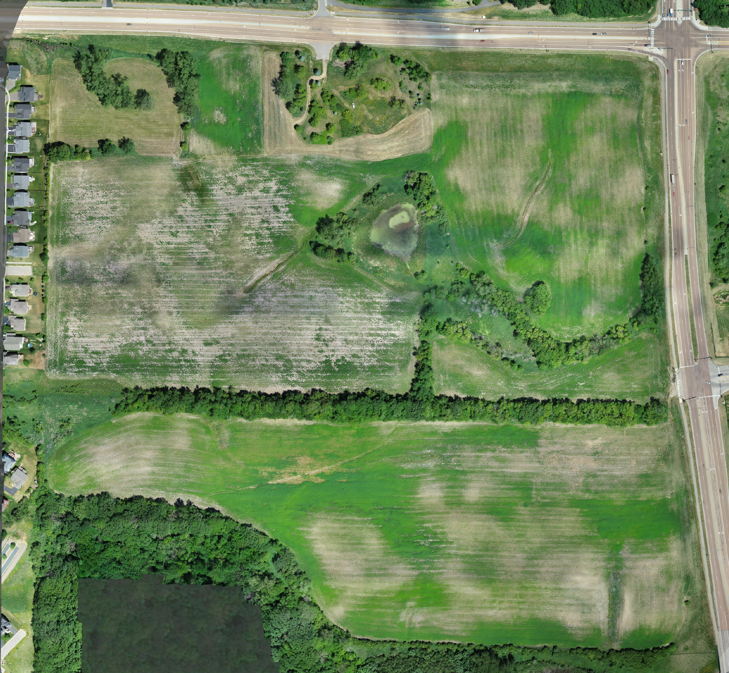
Our proficient land surveying team can leverage the power of drones to capture real-time, high-definition aerial photography and exceptionally accurate elevation data, rendering it ideal for surveying expansive undeveloped areas or farmland.
What distinguishes our drone survey services from other survey suppliers is our seamless integration of drone data with our adept survey professionals and state-of-the-art survey-grade equipment. This seamless fusion enables us to conduct surveys more efficiently without compromising precision.
Furthermore, we offer even more precise surveying services with our LiDAR Operations team, utilizing the latest cutting-edge drone and top-of-the-line LiDAR scanner.
To learn more about our LiDAR capabilities, contact us today to review a case study.
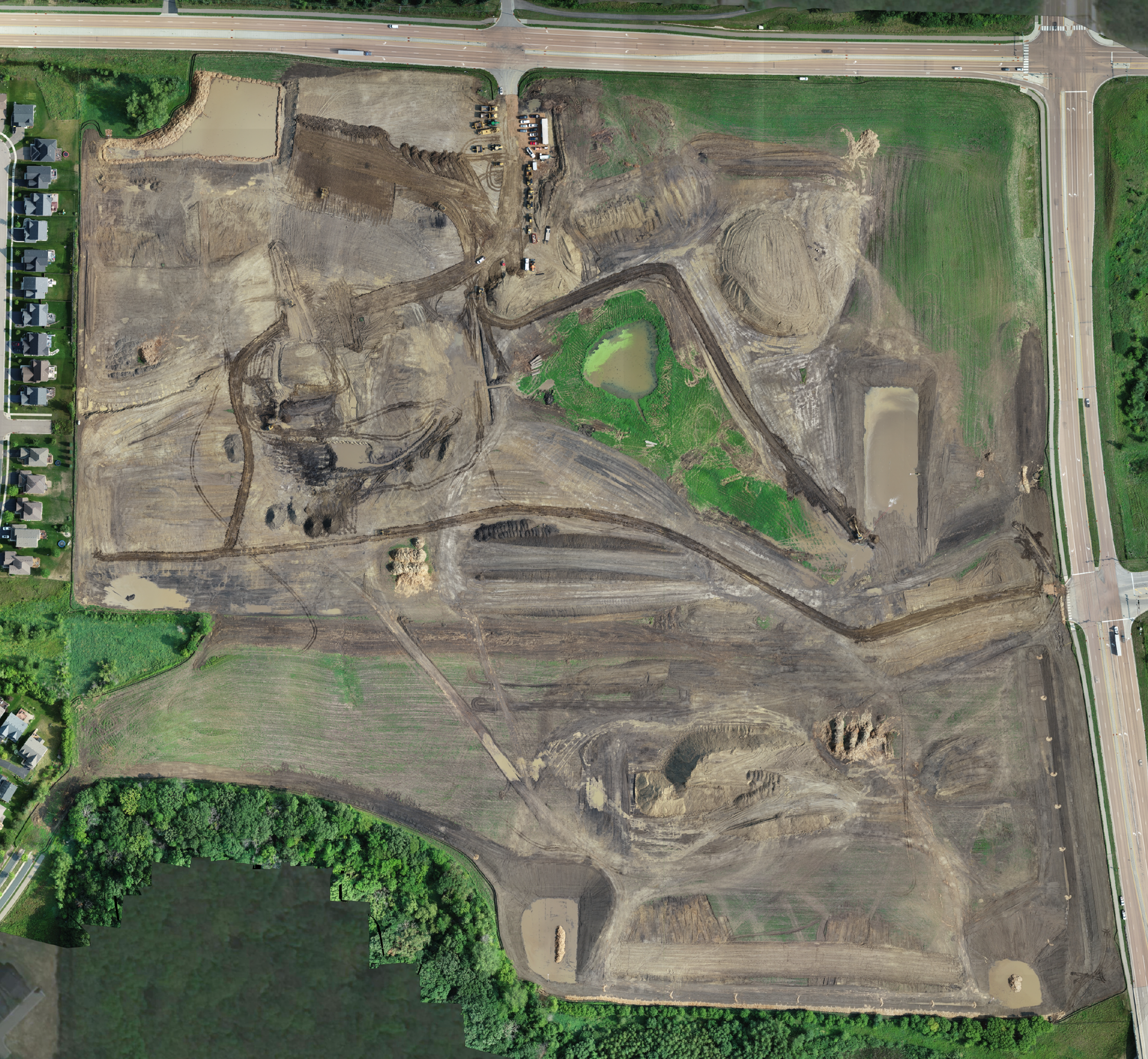
Construction
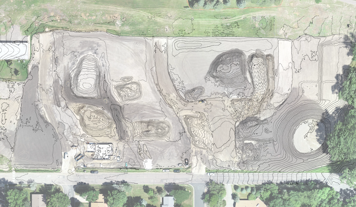
Landform’s Aerial Operations Team can significantly collaborate with your company to expedite your project timeline.
Our team delivers an expedient and precise means of measuring stockpile volumes, tracking earthwork throughout your site, and generating grading as-builts much faster and more accurately than traditional survey methods.
To guarantee the dependability and precision of our drone data, our team links drone ground control points (GCP) to our top-quality survey-grade equipment. By combining drone and survey work, our services bring greater efficiency to your project, eliminating the need for separate companies for each task.
All our survey crews are FAA Part 107 certified commercial drone pilots, so you can rest assured that the job is in competent hands. What’s more, Our experienced surveyors manage the drone flights, ensuring the accuracy of our drone data. Learn more about our FAA Part 107 certified team on our Drone Operations page.
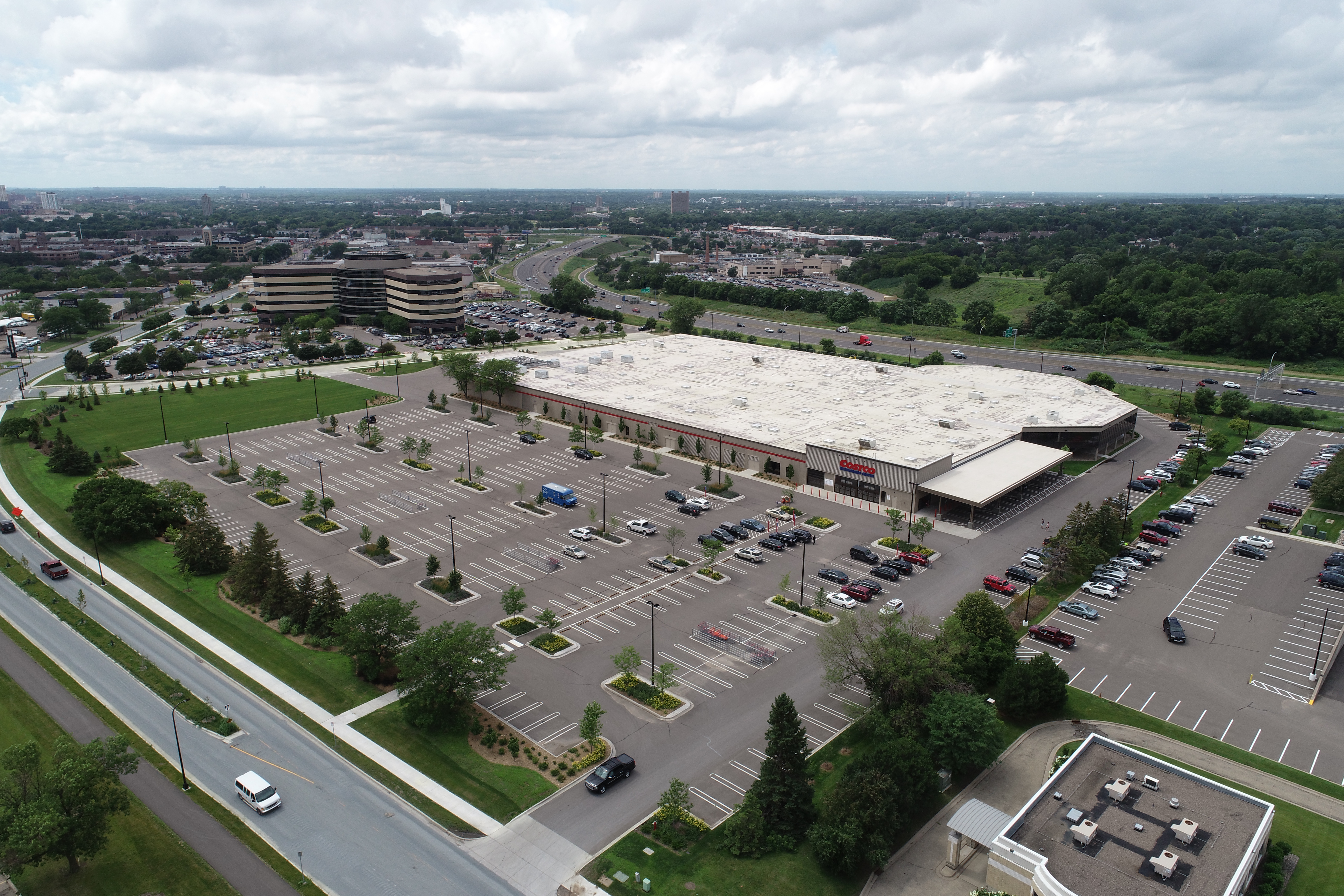
Site Comparison
Our team can employ professional-grade drones to fly over a site and capture high-definition photography for a photo slider comparison of large projects at a variety of process points throughout the project. Our drone survey services integrate data with our seasoned survey professionals and top-of-the-line survey-grade equipment to ensure maximum precision and efficiency.
This tool has proven invaluable for payment processes, volume analysis, accuracy validations, and more.
Orthomosaic aerial photo comparison at Avienda in Chanhassen, Minnesota
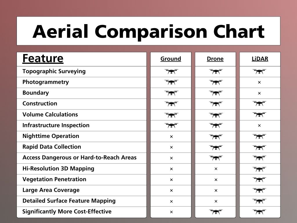
Not sure which Aerial Operations service is right for you? Check out our easy-to-understand chart below, or contact us today to review a case study.