Land Surveying
The team combines best practices of land surveying, drone operations, and the latest CAD software to produce premium survey products in a time frame that meets our client’s needs.
Today’s high land costs demand highly accurate, detailed surveys and the most comprehensive procedures from the field to the office to ensure that our client’s projects are problem-free and yield a maximum return on investment.
Our clients include large and small contractors, real estate lawyers, lenders, land title companies, municipalities, property owners, developers and corporations. Still, our strength is in providing in-house services to Landform’s three client-focused design studios. This efficient continuity of service ensures the survey team is integrated into the design process. This work culture provides seamless documentation, not rework, from which a design solution can emerge.
Our clients appreciate the quality and efficiency of our survey service and its contribution to all Landform projects. We provide complete land survey services directly for clients or in conjunction with our Residential, Retail & Commercial or Planning & Urban Design Studios.
Our services include:
- Boundary Surveys
- Topographic Surveys
- Certificates of Survey
- Plats & Registered Land Surveys
- Replatting & Parcel Splits
- ALTA/NSPS Land Title Surveys
- Condominium Platting
- Property and Easement Descriptions
- Tree Surveys
- Wetland Surveys
- Construction Staking & Layout
- Pipeline/Powerline Route Surveys
- Geodetic Control Surveys
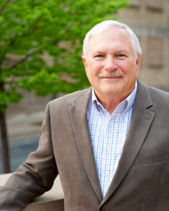
 Meet the land survey department’s lead, Lynn Caswell.
Mr. Caswell has over 50 years of experience in surveying. As the Senior Surveyor, he supervises Landform’s talented and growing survey team and guides clients through municipal and regulatory agencies for land development and significant planning projects.
Lynn is responsible for the implementation and supervision of quality control systems. Mr. Caswell is involved in site inspection and site suitability determination and conducts boundary and title analyses. He has provided project management and quality control for the construction staking of sewers, water and roadways for several hundred commercial, residential and municipal projects. He has completed the preparation of right-of-way acquisition easements for MN/DOT, as well as the preparation of easements for public improvements for the Cities of Blaine, Lakeville, Coon Rapids, Champlin, Milaca, Isle, Otsego and Zimmerman. He also has considerable experience in environmental permitting.
Awards:
- Surveyor of the Year – Presented to an active member for recent and significant contributions of time and talent to benefit society.
- William S. Kelley Jr. Community Service Award – This award is given to a member who has significantly contributed to the community.
- E.A. “Bud” Rathbun Award of Merit – Presented to an active member who served society over a long period in a specific category.
Key Projects:
- Summers Edge \ Plymouth, MN
- Cherrywood Pointe \ Minnetonka, MN
- 2700 University Apartments \ St. Paul, MN
- Harvest Estates \ Ramsey, MN
- Luther Chevrolet \ Hudson, MN
- Shidler/West Finance Partners – Alta Survey \ Minneapolis, MN
